Friday, June 24, 2022

Brianne and the Spooners

Sounds like this could be a country music band.  It is not, but the “country” still applies. Read on.

Day 27: Purden Lake Provincial Park to LaSalle Lake Campground.  66 miles.  +2,829’ elevation gain

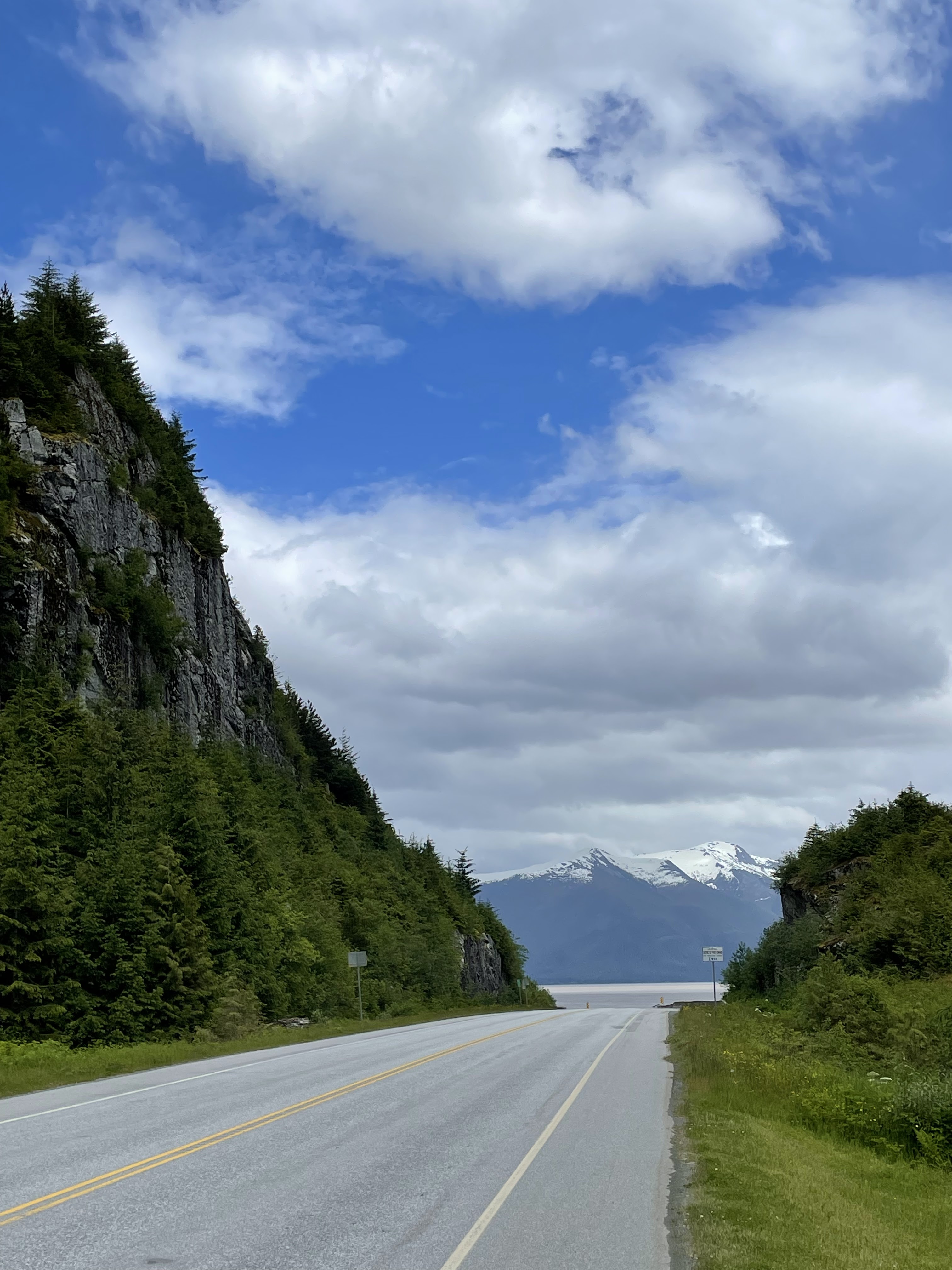
Aside from being absolutely swarmed by mosquitos, it also rained most of the night whilst in my tent.  In a way, this is a very soothing and comforting sound except when you really need to get up and get going (or do other business).  There was a break in the patter and I made a dash for it, packing up my soaked tent and eating my breakfast while pacing the drive lane to keep the skeeters chasing.  But mercifully, the clouds were suddenly breaking up, and the sun took over.  (See also blog post entitled “Hot Dogs”).  Overall, the ride was a roller coaster of hills with quite a bit of gain.  And there was literally nothing between Prince George and McBride – a distance too far to traverse in a day.  There was, just a bit north of McBride, a free, self-supported campground on LaSalle Lake.  I rolled down the steep hill (thinking ahead to morning when I must climb back) to a virtually empty campground. Scanning the options, I naturally took the best spot next to the Lake.  

My tent site at Lasalle - sweet, eh?

Resting on a picnic table, not 15 minutes passed when another truck rolled in and chose another nearby spot.  Then came another couple a few minutes later.  Two camper vans pulled in, and I offered them my first spot as it was convenient for two vehicles side-by-side. Several other vehicles pulled in, all of this activity within half an hour of my arrival.

The woman in the first pick-up truck to roll in said hello and asked a few questions, and was friendly while swatting mosquitos.  I asked her if she would let me store my food gear in her truck overnight to protect from bears (“yes, of course”). Over the next hour, we chatted more and introduced ourselves and our journeys.  She is a probation officer going to school to learn about natural medicinal therapies and is on her way to Banff to compete with a friend in a half-marathon the following Sunday.  That is Brianne.

Brianne

Little did either of us know that this particular campground was the party spot for McBride youth. Unfortunately, I was already all set up, but Brianne decided to take a more remote spot away from the expected party scene as she merely slept in her truck.  I was not so lucky, and kept my spot by the lake, chatting with the occupants of the van – two couples from Switzerland. Spoke a bit of German with them.

The partyers perhaps did me a bit of a favor.  As the talking and minimally diminished noise continued all night long, it was at a time more than my earplugs could withstand.  Awake, I had a brainstorm – if Brianne is going to Banff, she will be going right past the Lodge and Campground in Tete Jaune Cache (pronounced tay-jjohn cashay).  She could carry my panniers and drop them off on her way.  But would she?

DAY 28: LaSalle Campground to Tete Jaune Cache.  68 miles.  +2,239’ elevation gain

Morning came with two revelers still yammering at 6:00 am, and now with a bit of rain coming in.  I packed up my tent and walked to Brianne’s site and had my breakfast (she had my food), and posed the question of schlepping my gear (“yes, of course”).  Within about 20 minutes, my panniers were in her truck, I sent her a text message to connect with me, and then she was off to meet a friend in McBride for breakfast.  

The business office of the resort did not open until 7:30, so after she left I went ahead and called to let them know the gear was coming, and could I make a reservation.  A person on the other end of the line was barely understandable, said they had no vacancy, and really did not seem to understand me.  Now I was worried!  Had I made a mistake in not planning this better?   I double-checked the phone number on the website and had entered it correctly.  No use - something was off.  It is especially worrisome as many lodges and restaurants have closed due to COVID yet still have a web presence out there.

In this situation, there is only one thing to do – ride on and hope for the best.  As Brianne was planning to have a breakfast with a friend in McBride, I thought if I pedaled fast enough . . . hmmm.

My bike felt naked, yet exuberantly light.  I took off, and with some steep initial climbs and a morning rainstorm, I made excellent progress over the 30 miles to McBride, where I enjoyed a second skillet breakfast/brunch at the re-purposed CN rail depot.  No Brianne, but while there, Jim, a local 90-year-old veteran of the CN railroad, working in this same building for so many years, took a seat at my table and we chatted a good half hour about the Canadian railway system.  I bought him his bagel, which he appreciated.

Jim

Brianne should have already made it to Tete Jaune by the time I left the cafe.  I kept checking my phone for messages – none yet, so I carried on at a brisk pace to a clearing sky and minor tailwind.  I was flying without load, but also getting a bit worried.  I finally decided to call her to see if she had any issues.

Wrong number!

I entered the number incorrectly.  Now I was really worried.  She could not contact me, and I not her!  What if there was a problem at the Lodge?  I put the best spin on the next 33 miles I could, but was really just stuck with the hope that the Lodge did actually exist, was in fact open, and if there was no vacancy, I could (hopefully) fetch my bags and move on.  Ride on!

Enter the Spooners

I was about 5 miles or so north of Tete Jaune Cache when I spotted what appeared to be a slow-moving, pulsating mass far ahead.  As I approached a bit closer, I noted it was a group of cyclists.  Now earlier in my trip, on at least two occasions, people would ask me if I had run across another family that was pedaling across Canada.  I had not, and as they were well ahead of me, it is only remotely possible we would cross paths anyway.  But alas, here they were, grinding up a shallow hill, and I without my panniers cruising easily up to them.

As is customary going in the same direction as another traveler, a brief chat about where you are going is typical.  In this case, it was very simple: “so you are the family of cyclists I have heard about . . .” 

There on the roadside, we paused and introduced ourselves.  Tod and Carla, Caleb (15), Josh (13), and Solera(11) along with Daisy, the family terrier riding in her crate on the back of Tod’s rig – a loaded Surly Long haul Trucker.  This, dear reader, is something of an amazing scene, to see an entire family traveling.  As they had mentioned, they are often viewed as some kind of traveling circus.

The Spooners, L to R: Solera, Carla, Joshua, Caleb, and Tod.
Note the rain gear! 

I mentioned I was planning to stay at the Tete Jaune Lodge and Campground up ahead, and they are welcome to join me there.  But first, Solera, the micro energizer bunny wanted to ride with me, so we rode together for a mile or so and then awaited the others.  With a “see ya later – maybe” I headed off to put my mind at ease about my gear.

Solera, waiting for family to catch up after we rode together

Tete Jaune is nothing more than a crossroad and was a fur trader's cache back in the day right in the shadow of Mount Robson, one of the more massive and impressive peaks in British Columbia. It is not hard to find the lodge, and I anxiously rode up to the office.  Two ladies were chatting when I came in.  There was no obvious sign of my panniers, so I introduced myself and asked if a woman had dropped off my panniers earlier in the day.

"She did.  They are in the storage room.”  

(THANK YOU, Brianne, I silently yelled to myself in relief! But I still do not have her contact information to properly thank her, but will continue the search)

They had vacancies for cute cabins with a common campground washroom.  I booked two, one tiny one for me and a larger one for the Spooners.  I ran out the door just as Tod was rolling down the hill.  With a yell from me, I stopped him (he was in front) as the others came by, and told them that my gift to the Spooners was a cabin for his family, and was he interested?  We could dine together.  Yes, and the kids were delighted! 

Breakfast in front of the cabin

Tod is a former military police officer and a retired engineer in business for himself (and likely more accurate to call him a tinkerer and a maker), and Carla a nurse.  They hail from Vancouver Island and have traveled from Victoria (milepost zero on the TransCanada Highway – just as Rich and I did) just a few days before we departed.  We had a wonderful evening with a campfire (no rain), and even the next morning had breakfast before pushing off again on the road to Jasper.  Again, Solera insisted on riding with me, and as it was Father’s Day, it felt right to do so!  We finally parted at the Mount Terry Fox overlook.  I was headed the 63 miles to Jasper, including a long climb, and needed to get going.

That is the story of Brianne and the Spooners - some country kindness of strangers coming together.

POSTSCRIPT:

Day 30: Jasper to Honeymoon Lake Campground.  34 miles  +1,802’ elevation gain

Turns out, that was not the final goodbye. 

I rode into Jasper the previous evening and took a very expensive hotel room as I had planned for a day off in Jasper.  I do not care for Jasper. Too expensive, and way too touristy for my liking.  The authentic towns such as McBride are more to my liking, with authentic pride.  So instead, I decided I would camp up on the Icefields Parkway, at the Honeymoon Lake campground, a mere 34 miles of mostly gentle climbing. It checked all the boxes: potable water, food storage lockers (bear boxes) and a cooking shelter in case of rain, and of course a beautiful view of the lake.  

Honeymoon Lake at dusk; Shackle and Clevis Peaks sunkissed

I chose the hiker/biker site ($5 a night) and spent the late afternoon journaling, reading, dining, and napping – not necessarily in that order.  It was around 7:00 or so when I heard “Peter!” from a young girl’s voice.

Our campsite with Solera consumed with my folding chair

Yes, they too made the long trip to Jasper in one day and happened to end up in the same campground.  Another evening, this time for good.  It made my day!


Riding again with Solera, as she wanted it!

Bikes parked at Rearguard Falls - one of our stops

You can’t follow Brianne, but you can the Spooners, also riding for charity: the Great Cycling challenge.  Check out their Instagram posts at www.instagram.com/spoonerepicadventure  

Thursday, June 23, 2022

Through the Mountains: Rupert to Rocky Mountain House

It started with a wet, midnight ferry landing in Prince Rupert, the start of the Yellowhead Highway (Tete Jaune). It featured a steep climb over the Columbia Icefield on the Icefields Parkway, finishing in Rocky Mountain House (yes, a town name in the foothills) on the David Thompson Highway – in the rain!  Fifteen days, 879 miles, 21,723’ of total elevation gain.  Seven black bears and three cubs, several elk, deer, two wild horses, and a grey fox sighted along the way, often arresting my progress.  3,246,024 truck tires passed (of course I counted them!).  Perhaps most impressive of all, is the immense scenery, ever-changing, with a different vista around every turn. 

The route from Prince Rupert (west end on the Pacific) to 
Rocky Mountain House at the edge of the eastern prairie.

Sailing on the ferry up from Port Hardy provided the first real glimpse of the coastal range of mountains in British Columbia.  It was a stunning observation, yet also one that filled me with wonder as to what the road ahead would be like.  It is easy to wonder, perhaps even worry, about how challenging they would be to cross, and what the people and conditions would be like. As I do on my bike constantly, I now look in the rearview mirror at these now fading mountains and riverscapes as I descend into the “prairies” as the Canadians refer to them, with a sense of pride and accomplishment.  Rather than bore you with the day-to-day journal of these past 15 days, I offer you these five observations.

Weather

Nobody characterized the weather as normal.  Instead, it was characterized as an unusually cool and wet Spring and a late one at that.  It is not difficult to surmise that I wore my rain suit more often on this segment than I have in the past 5 years, and luckily it worked well enough to keep me mostly dry, and certainly warm enough.   It is conceivable that nearly every day had at least some rain, and a few days quite a bit of hard rain. I never expected to also wear my warmer clothes virtually every single evening or to wear my clothing to bed just to stay warm when camping.  I do not believe the daytime high temperature ever topped 65 degrees in the sun and was often in the low 40s at night.  I did not expect this.  And somewhere along the way, my long-fingered gloves were lost, exposing my fingers a bit more than I expected.  I resorted to buying nitrile gardening gloves at a small-town hardware store.  They worked well enough most times, but as I write this, the rain again beats own on the roof of my tiny motel room, as it has much of all day, and only in the low 40s.  I was probably the coldest I have ever been save once, those gloves did not keep my fingers warm, and I am now happy for the respite of a motel to finish this blog post.  

Many people ask me what one does in the rain.  You ride, or you hunker down somewhere.  Weather happens.  And I offer no pictures in the rain - for obvious reasons!

Geography

Mountains and rivers, hills and streams, and a thousand waterfalls carving drainage pathways can best characterize the geography.  Dress all this in evergreen, and top it all with abundant snow, and that is central British Columbia.  Leaving Prince Rupert, the Skeena River fairly crashes into the roadway as one descends a long hill east of town to join the road that runs along the river for miles.  

Joining the Skeena River for a long shoreline ride

The river watershed is guided by these rolling coastal mountains along both shorelines, and those mountains can also channel a mean headwind.  The Bulkley River, which drains into the Skeena, harvests the water of the broad central valley between the coast range and the Rockies, and both drain to the Pacific. The Yellowhead Highway farther inland follows the Fraser River that originates in these central uplands and flows in these upper reaches in a long, broad valley channeled by snow-capped peaks, flowing all the way to Vancouver and the Pacific.  

On the overlook of the Columbia Icefields

The Athabasca River along the Icefields parkway flows north to the Arctic Ocean, and the Saskatchewan River, on the southern side of Sunapta Pass on the Icefields Parkway, drains to the Atlantic Ocean through Hudson Bay, and yet how far I am from that ocean!  It is really hard to comprehend where all that rain I endured will actually end up (other than in my clothing!), and it is not obvious by mere observation.  No wonder the fur traders that explored these areas had a tough time figuring that out!  It is truly like a crumpled blanket.

On the south side of  the icefield, the road ahead extending
below in one of the most exhilarating descents! 

Mood and Character

There has been no shortage of people to talk to since many people see the loaded bicycle and ask about the trip.  And the people have been great! This stage of the trip exposed me to the varied opinions of British Columbia, of its shifting relationship with the land; the government owns 94% of all the land in British Columbia, called Crown land, and is making a push to limit logging and focus on tourism.  Logging and lumber mills are the lifeblood of most communities I rode through.  Reducing logging reduces the quantity of timber to sell, and also the amount of pulp chips as a byproduct.  Many foreign investors with lower labor costs in their mills do not become good stewards of these mills, and they are often closed down and salvaged for their equipment to be rebuilt elsewhere in the world.  It was startling to hear that many of the shipping containers stacked in Prince Rupert harbor are actually filled with whole logs to be processed overseas, bypassing the local mills.  The impression I got is the timber industry, for all the land available to sustainably manage, is dying a slow death in British Columbia.

The local lumber mill in the small village of Kitwanga

First Nation aboriginal members represent only 6% of the total population in British Columbia, and are stewards of only 0.4% of the land base, according to the 2020 Annual Report to Parliament. They are visibly much more “present” in society as a whole, but not always in the best light.  First, there are so many different “nations,” some quite small, and all are to various measures dependent on the government.  They are allowed to manage their own land and forestry resources but do not do so to build an industry as opposed to merely make a sale of the timber.  They often will contract for the timber harvest rather than have their own first nation forestry crews doing the work.  This causes frustration for non-natives.  And of course, like so many places, many members are marginalized in society, with a lot of homelessness in many of the towns I passed through. It’s a sad sight.  But then again, it always is no matter the ethnicity.  One thing I can say that pleased me was to see so much of the native art and culture on prominent display, and it did not seem “forced” but rather natural.  I have never seen so many totem poles outside of a museum and placed naturally within a community and environment.

The historic Gitwangak Totem Poles

CAVEAT: all that I have written here is gleaned from my conversations with locals, and should be taken as hearsay.  It is one view, but perhaps not the entire view. I am certain the advocates for throttling back on timber harvesting have sound reasons as well. And like any contentious issue, it is often uncomfortably played out in public and private, and often around a campfire.

Trucks

There are big trucks in Canada.  The “B-train” rig is an eight-axle tandem trailer set-up, and is quite common across Canada (and not universally allowed in the United States).  They drive big trucks because they have big loads, including the most common log hauler as well as tanker and pulp chip trailers. Canada needs trucks (and trains) to connect the various markets, but they can be intimidating to see in the rearview mirror after having heard them quite the distance arrears. The number of trucks might be an indication of the robustness of the timber economy, in which case, based on the numbers that I saw (and typically heard and felt), the economy must be good, though that is debatable (see paragraph above).  There were a lot of trucks on every section except the Icefields Parkway (not permitted), and the stretch from Prince George to Tete Jeune Cache.  By and large, they are good, professional drivers, but one could wish they would slide over just a bit more when passing, for the “whoosh” of the pressure draft as they pass can be a bit uncomfortable when the shoulder is narrow.  

Roadsides

Riding the roads at a slow pace does give one a chance to see what is actually along the side of the road, including trash.  About British Columbia as a whole, it is largely clean and free of trash.  This was a bit surprising to me, but for the most part, what I did see was stuff that could have flown off a vehicle rather than been dumped wantonly.  This was pleasing, that is until I came to the Icefields Parkway.  The number of aluminum cans tossed, along with other detritus, frankly surprised me!  Drivers that speed along at 60+ mph do not see the isolated piece of trash – it looks clean along the roadsides at that speed.  But it is there, not necessarily in abundance.  Why is there even one can?  What would cause a person to toss this out in such a wondrously beautiful environment in the first place?  It baffles me.

The other notable absence along this entire stage is road kill.  Rarely did I see a decaying or crushed animal along the roadsides; given the amount of animal movement, this was surprising.  I was pleased about that.  It is not that it never happens for there are warning signs everywhere, but it is nice to NOT see this.  The most common roadkill I saw was a handful of birds and some butterflies.  

From the perspective of all my previous 20 bicycle tours, I have seen much more wildlife than ever including bears, elk, bighorn sheep, deer, a fox, a wolf, and two wild horses - all from the roadside.  

This elk is a poser!  Right behind a frequent sign!

The most common object found: bungee cords, most broken. The most surprising object found?  A large, sheathed hunting knife laying neatly on the shoulder.  Yes, I picked it up (heavy) and brought it to the next convenience store. They were happy for me to part with it!

I can only say, consider a visit to British Columbia – you will not be disappointed!  But wait for the rainy season to pass.

FOR YOUR VISUAL PLEASURE, A GALLERY:

Purden Lake in morning following a full night of rain


Typical view of the Fraser River valley en route to Smithers

Honeymoon Lake on the Parkway at sunset


Yellowhead mountain, on way to Jasper

OK, you can stop now!


Monday, June 20, 2022

Hot Dogs

I consumed more hot dogs in 24 hours than I have eaten all year.  Permit some explanation.

Prince George was a major destination, the end of Stage 3 of my transect plan.  It was a light riding day, and I used the city to re-supply and re-organize my gear.  I managed to send 2,2 kilos of stuff I hadn’t used, and am likely not to use, home in a box.  Modest progress at lightening the load.  From my quite seedy motel, I was able to get some work done in the morning before heading out on another short day of 42 roller-coaster miles to Lake Purden Campground and Resort, but the morning was dreary and wet – again.  I waited until it let up a bit and then headed out of town.  It is important to know that between Prince George and Lake Purden, there is nothing but nature.  The route was dry for about 20 miles, and then I noted a dark cloud bank ahead and prepared by donning my rain gear.  Good thing, for within minutes, it poured and did not let up.  And not just the rain, but thunder and lightning,  I rode through it – there is nothing like a hard hunker-down-and-ride rainstorm with a bit of thunderous orchestration attached that yields a shot of adrenaline. 

I passed a Provincial Park campground in favor of the Resort as they would have had showers.  As I approached the resort, I noted with disappointment a CLOSED sign for the place, likely a victim of COVID as so many venues are.  Not wanting to trespass, and very concerned about bears with wild camping, I pedaled back the 2 miles to the nearly empty Provincial Park campground (pit toilets, no showers, but I think I already had one!).  The rain had let up briefly, so I found a good site close to a bear box (a secure metal box to store your food) and quickly set up camp, all the while swarmed by voracious mosquitos (out came the head net!).

That’s when Lori walked by.  Seeing me in my wet raingear with a bicycle setting up a tent, she likely felt a bit sorry for me and graciously invited me to come over to their RV site and get warm by the fire. As I was now fairly cold and wet, I (eagerly) accepted their offer.  Her husband Hugh, a retired welder in a pulp mill and search and rescue navigator, had made his own wood-burning stove that had a nice flue and could easily radiate the necessary warmth.  Then came an offer of wine (I’d love some), then a blanket by Lori draped motherly around my shoulders (no choice but appreciated), and then an offer of grilled hot dogs with onions on the stove (ahh . . YES!), with a homemade bun to boot!

Under the awning and blanket with Lori and Hugh

Suffice it to say the evening extended to about 3 hours of conversation, a bit more wine, and dry warmth under their awning, me draped in a blanket.  And the hot dog was perhaps the best ever tasted given these circumstances.  I crawled into my tent and quickly fell asleep, waking off and on listening to the rain continuing through the night.  Nuts!

Awake early, what seemed an abatement in the rain prompted me to get up and get the soggy tent taken down, and to quickly eat breakfast while walking about, trying desperately to stay ahead of the mosquitoes.  Optimistically, the sun was trying to break through the clouds as the forest still dripped with wet freshness, and eventually, banished the clouds for solid blue skies.  I was off with the prospect of warming sun to lift my spirits.

Purden Lake

I was headed for LaSalle Lake Campground, some 66 empty miles down the road.  There were no towns.  But Hugh and Lori did tell me about the Ancient Forest (Chun T’oh Whudvjut), an area of a narrow rainforest micro-climate that supports an old-growth forest of cedars believed to be well over 1000 years old.  

The Ancient Forest - while not as big as the redwoods,
they are slow growing with tight rings. Over a thousand years old!

I try to pace myself for a lunch stop after 30 miles into the day, and just as I was contemplating where to stop, I saw the sign coming up for the Forest and decided that would be the location for my lunch, and a tour.  Unexpectedly, the parking lot was crowded even though there had not been much traffic.  There were two school buses parked, and as I approached the picnic shelter, the middle school kids enjoying a field trip on their last day of school (and perhaps not enjoying hiking up steep trails looking at old trees).  I was quickly ushered in by the Vice Principal and the parent chaperones supporting the trip to have a hot dog (and a grilled bun), chips, and water.  I managed two of them – they tasted so good.

The Hot Dog Mom's!

The field trip

I should have been worried.  Many years ago on another tour in Alberta, I stopped for a hot dog as a mid-afternoon snack, an endeavor I had vowed not to repeat as it felt like I had added many pounds to my load with my gut hanging over my top-tube for what seemed a very long time.  Yet here I was, soaking in the moment, and genuinely appreciating the parents and their hospitality.  The kids were soon gone, the shelter empty (and a place to dry the tent) while I toured this magnificent grove of trees.  I could only walk past these giants and think: “you were as tall as me in, perhaps, the year 1022 – just look at you now!”

And look at me now.  I might have to break my vow of avoidance regarding hot dogs.  I did ride off into the warm, sunny afternoon remarkably satisfied.  Four . . . and counting! 

Wednesday, June 8, 2022

Past Vancouver Island

After 5.5 days of mostly wet and cloudy riding, the sun finally broke out this morning into a beautiful sunrise over the bay in Port Hardy, the northern tip of Vancouver Island.  Time to board the ferry for Prince Rupert and mainland Canada through the "inside passage" along the coast of British Columbia.

This meant a very early rise to make a 6:00 AM deadline to check in for a 7:30 departure.  But as my anticipation and interest in this particular voyage has been in place since grad school in 1980, it was certain that sleep would be fitful anyway. And now, with a clear sky and stunning views, it is easy to reflect on the “island.”

Notwithstanding the challenging start due to the accident, Vancouver Island was well worth its service as our starting point.  The city of Victoria is charming, with an English vibe mixed with a cosmopolitan, youngish air.  Enjoyed visiting the Parliament building, and especially the single chamber where the political deliberations take place.  Reflecting on that, it represents, at least physically, not a “house divided” but perhaps, even hopefully, a room where deliberation and consensus can take place.  Might be a dream, but the physical oneness of the ornate chamber inspired that thought.

British Columbia unicameral Parliamentary Chamber

For a bicyclist, riding on the island is generally easy.  Victoria is a very bicycle-friendly town, much to the chagrin of many locals who complain about parking and easy access to downtown being removed.  I get it.  The infrastructure of bike lanes and safe crossings in the urban area, not to mention the many bike trails, is quite significant.  However, there is also a lot of traffic on the island (especially pick-up trucks), all the way to Campbell River and the start of the “north island” region. That was, perhaps, the only downside to the journey (other than the persistent rain), and no doubt a contributor to the accident.

The galloping Goose Waterfront Trail in Victoria;
some splendid infrastructure

As a sort of barrier island from the Pacific tradewinds, Vancouver Island is the most temperate area in Canada, with temperatures that do not vary far from the 50’s to 60’s, at least in the lower coastal areas.  The mountainous spine of the island manages to capture quite a bit of rainfall, resulting in a very lush, verdant landscape.  I was fortunate for timing the peak blooming period of rhododendron, azalea, hawthorn, and other species that gave this old gardener “flower-lust”, especially when visiting the incredible sunken and Japanese gardens at Burchart.

The incredible sunken garden at Burchart - a former quarry.

Some coastal riding in a brief moment of sunshine.
Rain can come quickly

Of course, for a flatlander, crossing this mountainous spine on the northern half is required to get to Port Hardy, and somewhat intimidating.  In spite of the rain, I managed to depart Seyward in the morning during a rainless moment and make the two biggest climbs over nameless passes.  The morning afforded magnificent glimpses of the steep, snow-capped peaks while slowly grinding up or gently coasting down the slopes.   Not high in terms of overall altitude, the mountains are steep-sided and often fall directly into the seas, creating numerous fjord-like inlets with fishing villages tucked at the end of the bay – villages left for exploration some other time but well published as tourist destinations in their own right.

Hwy 19 across the mountainous spine - north island:
the rain stopped in the morning, and continued all afternoon


Perhaps the most important reflection I make is that of the people.  I was fortunate to have three Warm Showers hosts.  I have already spoken of my saviors, the Paxman's, hosting me during my friend's accident recovery.  But I have not mentioned Bob and Dorothy Simpson, Darla Love, and Stephanie Tuck (and her dogs!).   Strangers freely come up to chat, especially a touring cyclist.  Bob did so during the accident and offered his accommodation that I gladly took up in Nanaimo, with Darla escorting me out onto the right path northward the following morning. 
 
Bob, Dorothy and Darla, ready to send me off northward.

Stephanie Tuck hosted me in Courtenay in a waterfront home with her two rescue dogs. A med-tech consultant working from home, she also is a foster for shelter dogs, finding new homes while keeping them from a darker future.  This passion mixed well with our charity link to CanDoCanines.  Her friend Steve joined us for dinner and conversation that was memorable and warm.  

Stephanie's dogs, Kai and Lena, sending me off in the rain.

The most visible aspect that quite impressed me about the people is the ingrained “inclusion” of words and symbols from the many first nations.  What is striking to me is that many of the first nation tribes remain on their original lands, often a cove or inlet and the landscape surrounding it.  An informational banner posted in Woss shows the many tribes just within the north island region. (all the black labeled titles on the image are separate tribes)


Integration of language on signs as well as the unique Pacific Northwest symbolism represented in the art is everywhere.  I cannot say whether some of this might be considered cultural appropriation, as for example, symbolism integrated into a Rotary International sign, or whether the club is populated and embraced by the indigenous.  There is so much more to learn about the first nations here that this trip does not permit. But like many places in North America, there is abundant evidence of their marginalization within the greater society. 

Perhaps it is best exemplified by coming across a random totem pole sitting in the estuary adjacent Port Hardy that I passed this morning.  There is a story there that further study might reveal, but for now, we sail north to Prince Rupert and the point of departure for my continental crossing. 

A totem along the estuary dike in Port Hardy
 I wish I knew its meaning

ARRIVAL!

Arrived in Prince Rupert, last to leave the boat at 12:30 AM, and had to ride to the hotel - IN THE RAIN!

Words cannot adequately describe the pure, raw beauty of this voyage.  Imagine a green rumpled blanket, draped over the dark blue sea, perhaps covering spirits or mythical creatures you may have imagined as a kid.  Cast expanses of snow at the high crumpled peaks, and let imaginary cascades of water flow between the ripples onto the sheet of water. 

That would be the inside passage:  


Wednesday, June 1, 2022

Start. Stop. Restart (minus) 1

This cloudy day does not reflect the joy of the day: Rich is going home.

Let’s back up.  Rich and I departed Minneapolis on May 22nd for Seattle, leaving directly from Good Weather Bicycles downtown for the ferry to Bainbridge Island.  We spent the first night in Poulsbo and enjoyed a festive Viking celebration in this small town.  The next day, we lumbered up to Port Angeles, taking in about 3,88 feet of elevation gain with our freshly loaded bikes and traversing around 66 miles that we deemed “good training.”  After a night in a small, decent motel, we took the mid-morning ferry to Victoria, British Columbia, making landfall on Canadian soil mid-afternoon.  Staying at the Days Inn overlooking the harbor, we had the remainder of the day and much of the next to see the sights, enjoy some good food, and pleasant strolls.

Parked bikes on deck of ferry to Victoria, in view of
Olympic Mountains

All was going well.

We departed Victoria north toward Burchart Gardens and took in the springtime splendor of this extravagantly beautify botanical treasure while also enjoying a sandwich from the Red Barn, a kind of country market with a splendid sandwich bar, all the while traversing a maze of bike paths that crisscross Victoria.  It is really a bicycle-friendly city.


Sunken Garden at Burchart, an old quarry restored to a garden over
100 years ago 


In the meantime, using the Warm Showers app, we scored a homestay with Marvin, Erika, and Emily Paxman across the Saanich strait from Burchart.  The Mill Bay Ferry took 25 minutes to reach the far shore on the site of the Malahat Tribal area.  Ending with a steep climb up to their house, we were warmly received by the Paxman's for a single night – including a warm shower!  

All was going well.

Time to head north out of the Victoria environs toward Nanaimo by way of mostly country roads – best that I say very hilly country roads over 50 miles.  This was a good test of what was possible on this trip.  The main highway was constantly busy with traffic but perhaps with the advantage of less steep gradient. But the country road scenery was quite beautiful, pastoral, and passing through small towns like Chemainus with a wonderful lunch spot and views of many murals, for Chemainus proclaims itself the mural capital of the world.

The first camping night took place at the Living Forest campground where we had a beautiful site overlooking the broad river estuary and the mountains beyond, as well as an adjacent picnic shelter that proved convenient when it started raining.

In spite of that, all was going well. 

Friday, May 27th:  we were greeted by a gloriously bright morning sunrise, enough to quickly dry the tents and enable our departure.  We covered more bicycle routes through downtown Nanaimo, taking in the harbor, in search of a bakery that might have supplanted our slim breakfast of oatmeal.  We did not find one but continued out of town on quiet bike routes that finally ended in north Nanaimo where we had to rejoin one of the main routes: 19A . 

A further aside.  When Rich and I ride (we have taken numerous trips together), our motto is “just go”.  We ride at different speeds and I am normally ahead of Rich and await him when we have a turn as I usually navigate the route.  I merged onto the Highway 19A generous shoulder, crossing an on-ramp to do so, and started a coast down a gradual hill heading north.  Suddenly, a car comes by me closely and parks in front of me on the shoulder.  I slowed down so as to pass carefully when a man speaking French asked me if I was riding with someone.  I said yes. “He has been in an accident! A truck has hit him

I looked back up the hill, terrified, and saw traffic stopped at the on-ramp.  I turned and started to ride hurriedly back up the hill but was in the wrong gear.  I just jumped off the bike and ran/pushed my way about 200 yards back up the hill, thinking “No! No! No!. Not on my watch!”  I was personally terrified as I have never been before.


The terrifying scene with Rich tended to in the mainline on right

A few bystanders were kneeling around Rich when I arrived.  He was bleeding profusely, his eyes batting wildly, and his breathing stunted. Someone had called 911.  I carefully pulled his helmet off and planted my bandana on his head gash to stem the bleeding all the while yelling at him to stay awake and not go unconscious.  I thought I might lose him, right there, on the pavement of the mainline. He was trying to get up, and we held him down when an off-duty EMT came up and started to assess and administer first aid.  Soon after the local police arrived, followed by the Royal Canadian Mounted Police (RCMP - our equivalent to State Troopers), and then finally, seemingly endlessly, the EMTs arrived and took over.

I could now only stand and watch, horrified – I felt so alone.  I was interviewed by the police and the RCMP, as well as some of the medics trying to get information.  The highway was completely stopped in both directions.  A medivac helicopter landed on the highway. And then I was able to take in the enormity of the situation, and how it might have happened.

A large pickup truck driven by an elderly gentleman was on the on-ramp and accelerating, perhaps even looking backward over his left shoulder to see if cars were coming. Rich was crossing from the mainline right shoulder, across the on-ramp lane, to reach the far-right shoulder of the on-ramp.  Somehow, both of them did not see the other, and the truck hit Rich squarely at the headlamp/fender and launched him into the adjacent lane.  The small trailer that he tows his gear with was crushed under the driver's side front wheel and at a stop some distance from where Rich was lying.  The gentleman was obviously in shock.  I talked to him, and tried to provide some comfort, as he was “sick to his stomach.”

As Rich was being wheeled to the helicopter from the ambulance, he appeared somewhat alert.  I spoke to him as he was being placed into the helicopter, and told him I would be there for him as soon as I can.  The EMTs said he would be OK.

I watched him leave, sitting some 100 miles north of where they were going to take him (Victoria General Hospital) sorting through what had just happened, what I would do next, and waiting to find out what would become of his bicycle and gear.

Off to Victoria by Medivac

I took a chance.  These kind people – the Paxman’s – had casually mentioned that if we needed anything just to call them.  I did.  Marvin, who was playing pickleball, answered and when told of the incident, said he was on his way up with the van.  At this same time, another gentleman, Robert Simpson, came riding up to me as I stood on the shoulder and offered any assistance he could as he lived very nearby, and was a former bicycle shop owner.  I graciously said I had a pick-up arranged, but took his name and number just in case. This unfolding event was nowhere near over.

Dear Reader, what follows is an extended display of kindness from strangers that carry one through tough times.  Today, as this is being written, I have returned to Nanaimo and expect to re-start my journey, now solo, across Canada tomorrow, nearly a week later than when things were going so well.

I had to wait at the side of the road, seeing the truck and his crushed gear, while the traffic investigation was done.  All of the scene was a police jurisdiction zone and nothing could be taken from it until after the investigation.  After some pleading, I was able to get his watch, wallet, and cellphone, not knowing how long this investigation would take.  The wrecker finally came and carted away the debris and told me I could claim it after the police investigation in their yard.  An hour passed, and the highway gradually opened. Apparently, this event was now all over the media waves and particularly on TV and newspaper news, heard up and down from Victoria to Nanaimo. 

I finally was able to move to a commercial area nearby, walking my bike, to await Marvin.  Hungry, with a Dairy Queen on the corner, I had a milkshake, certainly sufficient to cool my thoughts but not my nagging worry.  Seemed forever for Marvin to get here, but he finally showed up.  We were able to claim his gear and then proceeded to drive the 100 miles to Victoria General Hospital.

Events somehow manage to get in the way of best-laid plans.  There was a major structure fire in Mill Bay that shut down the main road, resulting in an enormous traffic delay – one of the worst I have ever witnessed, with stopped vehicles snaking slowly around the rural roads on which a detour was laid. I was worried about Rich and desperately wanted to see him as soon as possible.  Throughout, our “biking buddies" messaging system was running full steam with everyone worried and wanting updates.

This was a very, very long and difficult day.  We were able to get to the hospital by about 6:30pm, as Rich was just transferred from the Emergency ward to the orthopedic ward.  Much to my relief, he was doing OK, quite banged up, tired, the worse for wear (and tear).  We went home to Mill Bay, and I slept well.


Our Warm Showers saviors: Marvin and Erika Paxman

Fast forward to today, June 1st.  Rich, whose smile and sense of humor was restored, was discharged and left the hospital for the return to Minnesota.  I have spent the last 4 days commuting by bicycle and ferry to the hospital daily to keep him company and be aware of plans (and how they can change).  I listened to the docs and nurses.  The crew on Ward 5A was terrific.

The smile is back with temporary tattoo's

They brought Rich back to life – maybe not physically as he is on the mend, but I think mentally as his disposition and capabilities improved markedly every day I was there.

So yes, there was joy today.  Rich is going home.  And it is not in a box.  He is a lucky, resilient man.  Perhaps best of all, he remembers almost nothing of the entire event.

Going home!

Time to restart this journey, minus one.